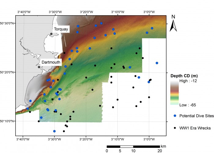
Distribution of First World War wrecks within the Devon study area (image credit: Contains public sector information, licensed under the Open Government Licence v2.0, from the Maritime and Coastguard Agency).
As part of the Forgotten Wrecks project this summer the Maritime Archaeology Trust sent out a team of divers to find and document a number of WW1 wrecks off the South Devon Coast. In order to assist the divers in finding these wrecks bathymetric maps were consulted. Much like navigational charts used by mariners these maps show the topographic features of the seafloor. However, modern techniques such as multibeam bathymetry, paint a far higher resolution image of the seafloor with measurements made every few metres. As a result, even fine details such as the orientation of shipwrecks and the positions of larger objects such as boilers and anchors on these sites, can be seen.
Within the area surveyed by the Maritime Coastguard Agency between 2012 and 2015 (data freely available from aws2.caris.com) 31 of the 48 wrecks which had been identified as lying within the south Devon study area reviewed ahead of diving operations were visible.
Once identified a zoomed in map was created of each wreck. The examples shown here are of the British Navy trawler, the Benton Castle and cargo ship, the Newholm. Both of which sank after hitting mines, leading to the loss of 30 lives in total. These images and images of the other wrecks were used by the diving team to help select individual sites to dive and then plan their dives more effectively.
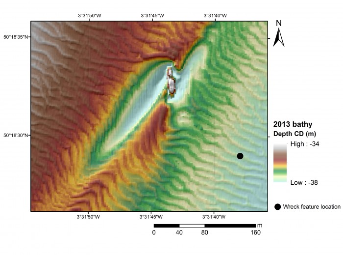
Geophysical survey image of the Benton Castle (image credit: Contains public sector information, licensed under the Open Government Licence v2.0, from the Maritime and Coastguard Agency).
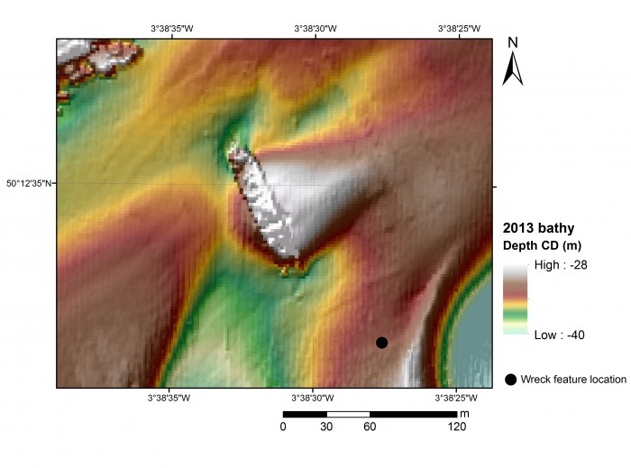
Geophysical survey image of the Newholm (image credit: Contains public sector information, licensed under the Open Government Licence v2.0, from the Maritime and Coastguard Agency).
The dive team operated out of Dartmouth using Falcon Diving Charters (http://falcondivingcharters.com/) during the week of 27th June to the 1st July. Despite some challenging weather conditions the team managed to reach a number of the Forgotten Wrecks to undertake survey and photogrammetric recording.
Written by Amelia Astley
To find out more about the Forgotten Wrecks of the First World War project, click here.
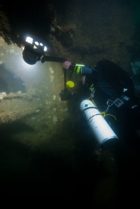
Diver photographs detail of the wreck structure of the Newholm.
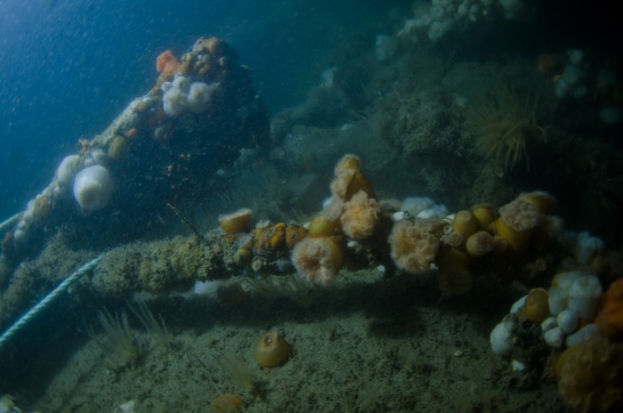
Marine life encrusts the remains of the wreck of the Benton Castle.