Maritime Archaeology Updates

Diving Deeper with the Maritime Archaeology Trust

Tag: WWII

Forgotten Wrecks of the Devon Coast: Geophysics and Diving

WholeAreaMap

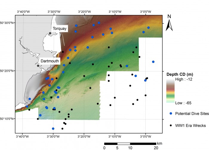
Distribution of First World War wrecks within the Devon study area (image credit: Contains public sector information, licensed under the Open Government Licence v2.0, from the Maritime and Coastguard Agency).

As part of the Forgotten Wrecks project this summer the Maritime Archaeology Trust sent out a team of divers to find and document a number of WW1 wrecks off the South Devon Coast. In order to assist the divers in finding these wrecks bathymetric maps were consulted. Much like navigational charts used by mariners these maps show the topographic features of the seafloor. However, modern techniques such as multibeam bathymetry, paint a far higher resolution image of the seafloor with measurements made every few metres.  As a result, even fine details such as the orientation of shipwrecks and the positions of larger objects such as boilers and anchors on these sites, can be seen.

Within the area surveyed by the Maritime Coastguard Agency between 2012 and 2015 (data freely available from aws2.caris.com) 31 of the 48 wrecks which had been identified as lying within the south Devon study area reviewed ahead of diving operations were visible.

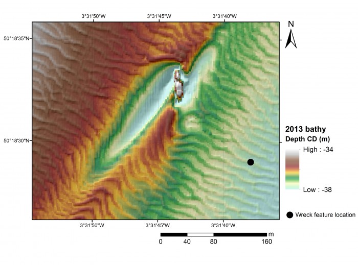
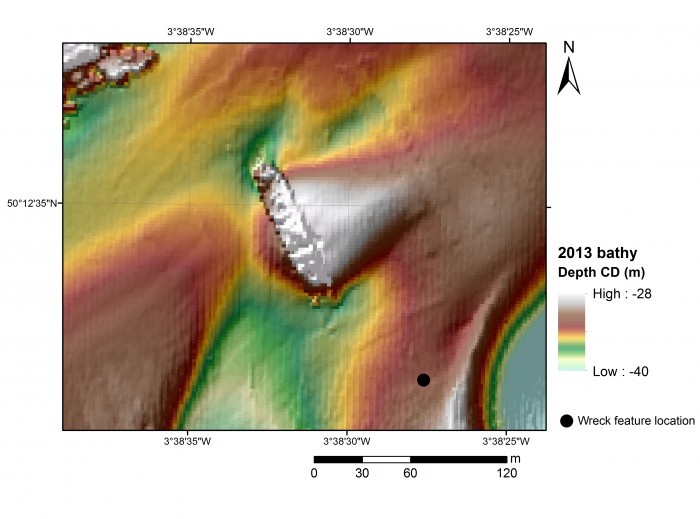
Once identified a zoomed in map was created of each wreck. The examples shown here are of the British Navy trawler, the Benton Castle and cargo ship, the Newholm. Both of which sank after hitting mines, leading to the loss of 30 lives in total. These images and images of the other wrecks were used by the diving team to help select individual sites to dive and then plan their dives more effectively.

BentonCastle_geophysics

Geophysical survey image of the Benton Castle (image credit: Contains public sector information, licensed under the Open Government Licence v2.0, from the Maritime and Coastguard Agency).

Newholm_geophysics

Geophysical survey image of the Newholm (image credit: Contains public sector information, licensed under the Open Government Licence v2.0, from the Maritime and Coastguard Agency).

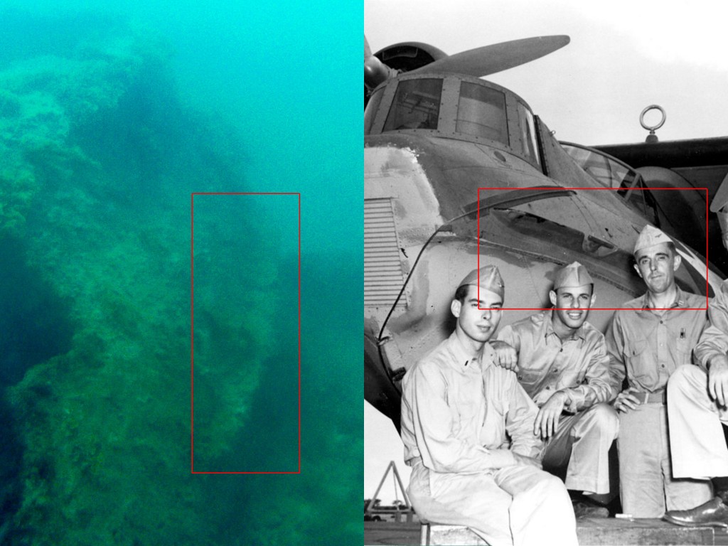
The dive team operated out of Dartmouth using Falcon Diving Charters (http://falcondivingcharters.com/) during the week of 27th June to the 1st July. Despite some challenging weather conditions the team managed to reach a number of the Forgotten Wrecks to undertake survey and photogrammetric recording.

Written by Amelia Astley

To find out more about the Forgotten Wrecks of the First World War project, click here.

Newholme_site_photo

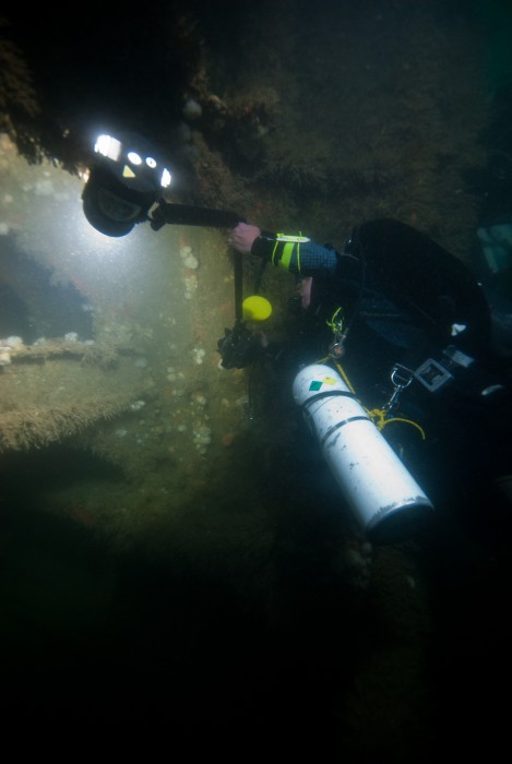
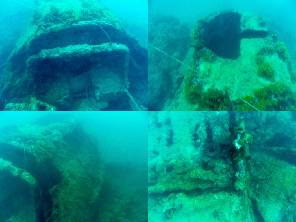
Diver photographs detail of the wreck structure of the Newholm.

Benton_Castle_site_photo

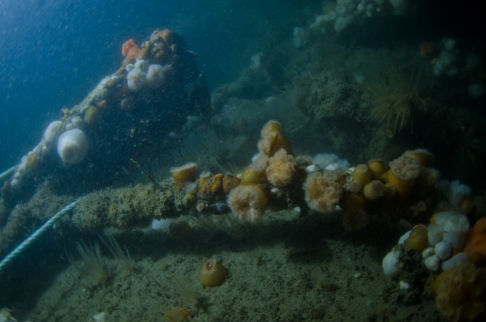
Marine life encrusts the remains of the wreck of the Benton Castle.


Identifying a Catalina

Consolidated_PBY-5A_Catalina_in_flight_c1942

In February we were contacted by a member of the public who’d recently enjoyed a trip to the Caribbean. Whilst there, he’d been diving off the island of St Lucia and visited the wreck of an aircraft. It was, he said, just inside a reef in shallow water but difficult to access as the waves break over the reef in windy weather.

He only had the one opportunity to visit and even then, could not explore the whole aircraft. With no information available from the team who guided him to the wreck, he was curious as to what it may be and, on his return to England, contacted us to see if we’d be able to help.

DIGITAL CAMERA

Images courtesy of Alan Foster

His photos illustrate some of the difficulties in maritime archaeology – namely visibility and recording. Not only had the diver been unable to reach the rear of the aircraft, but they hadn’t even been able to see it. Additionally, it is very difficult for someone viewing the photographs later to gauge the scale of the wreck – which is exactly why scale rulers are so important in archaeological recording (not that we would expect a diver on a pleasure dive to take scales with them purely for our benefit!).

The query was sent through to the Trust’s military history expert, Stephen Fisher. At first it looked like a hopeless task as it was barely possible to work out what any part of the front of the aircraft the photographs were looking at, but Stephen was struck by a solitary feature, visible in the bottom left photograph. This strake reminded Stephen of a similar feature he had seen on the nose of the Consolidated PBY Catalina flying boat, a famous aircraft from the period of the Second World War.

DIGITAL CAMERA

Working on this hypothesis, it didn’t take long to match up the other seemingly random features with the Catalina.

DIGITAL CAMERA

DIGITAL CAMERA

Right hand photo by Aleksandr Markin [CC BY-SA 2.0], via Wikimedia Commons.

With the type of plane now known, it made identifying the actual plane a lot easier. The book BusNos!: Disposition of World War II USN, USMC and USCG Aircraft Listed by Bureau Number by Douglas Campbell lists two possible candidates:

  • Aircraft 2400 Consolidated PBY-5 Catalina (Naval Patrol Squadron 31) based at San Juan, Puerto Rico, reported as having ‘water looped during landing and sank 30-Apr-42 at St Lucia’.
  • Aircraft 7249, Consolidated PBY-5A Catalina (Naval Patrol Squadron 92) ‘force-landed after engine failure and drifted onto reef and sank 14-May-42 St Lucia.’

There were only minor differences between the 5 and 5A and because of the sheer number of individual variations, even between planes of the same model (such as the forward gun position), it wouldn’t be easy to tell one from the other based on the images. The description of Aircraft 7249 sinking on a reef obviously suggests it may be that one.

The diver has passed all of this information to his contacts in St Lucia. Further research and dives to identify this aircraft can now at least focus on two specific aircraft and look for clues as to which it may be.

With thanks to Alan Foster.