Maritime Archaeology Updates

Diving Deeper with the Maritime Archaeology Trust

Tag: Maritime Archaeology Trust (page 2 of 3)

Volunteer in Focus: Richard Wyatt

In light of National Volunteer Week 2017, the Maritime Archaeology Trust would like to highlight some of the important work contributed by our volunteers. We sent out a questionnaire for our volunteers to fill in and give us their view on what it is like to volunteer for the Maritime Archaeology Trust. This is what Mr Richard Wyatt thought.
What do you do as a volunteer for the Maritime Archaeology Trust?

Production of Podcasts, re-organisation of basement storage, on-line research, field surveys, archive research, Fort Victoria audios, Maritime Bus, website proof-reading and editing, IT support.

How did you get involved?

An interest in archaeology (via ex-girlfriend), love of sailing & the sea (star-sign Cancer) via SVS and enthusiasm of Gareth Owen.

Anything you have learnt from working with the Trust?

Survey techniques, use of audio equipment (including software), the beauty of 1st edition OS maps, the mind-boggling resource that is the National Archives. Oh, and a great deal about the Hamble River (except whether it should the River Hamble.)

Have you enjoyed anything in particular?

The session at The Admiral Sir Lucius Curtis after re-organising the servers, getting out of the wind and onto a relatively smooth surface after several hours on Oyster Island, and the engine-room of SS Shieldhall. But especially the assistance and appreciation of the MAT team.

To learn more about what kind of work our volunteers do for the Trust, see the following blog post: http://blog.maritimearchaeologytrust.org/national-volunteering-week-1st-june-7th-june-2017/

Have you got a spare hour or day in the week and looking for something to do? Fancy learning new skills in archaeology? Want to learn more about our maritime heritage? Well why not drop us an email on volunteering@maritimearchaeologytrust.org today and find out more?
Volunteer in Focus: Rachel Patten

In light of National Volunteer Week 2017, the Maritime Archaeology Trust would like to highlight some of the important work contributed by our volunteers. We sent out a questionnaire for our volunteers to fill in and give us their view on what it is like to volunteer for the Maritime Archaeology Trust. This is what Ms Rachel Patten thought.

What do you do as a volunteer for the Maritime Archaeology Trust?

I do data entry which has so far included:

Entering information about shipwrecks of WW1 from different sources such as digital copies of old shipping documents and researchers hand written notes into an Excel database.

Inputting survey data from questionnaires given to people at event talks into an online database.

Making digital copies of physical documents and sorting documents into the correct folders.


How did you get involved?

I wanted real world experience in data entry so an education and employment advisor from the council suggested the Maritime Archaeology Trust to me.


Anything you have learnt from working with the Trust?

I have learnt of the vast amount of work done by the trust to keep people informed about marine archaeology and in particular the work done about the shipwrecks of WW1 and WW2.

I have learnt of the sheer amount of wrecks in the local area.

I have learnt how they are using virtual reality in order to show people the wrecks.

I have learnt how to do data entry with a variety of sources and applications.


Have you enjoyed anything in particular?

I have enjoyed the variety of work I have been assigned.

I have enjoyed working with a happy and supportive team.

To learn more about what kind of work our volunteers do for the Trust, see the following blog post: http://blog.maritimearchaeologytrust.org/national-volunteering-week-1st-june-7th-june-2017/

Have you got a spare hour or day in the week and looking for something to do? Fancy learning new skills in archaeology? Want to learn more about our maritime heritage? Well why not drop us an email on volunteering@maritimearchaeologytrust.org today and find out more?
Qatar Marine Archaeological Project (QatarMAP)

The Qatar archaeological research and exploration project built on the work undertaken by the Qatar Museums to locate and record the submerged cultural heritage. The aim of underwater fieldwork was to begin condition surveys of known submerged marine archaeological heritage sites. The results will enhance the maritime Historic Environment Record with the additional benefit of making the underwater heritage resource more accessible to the Qatari population.

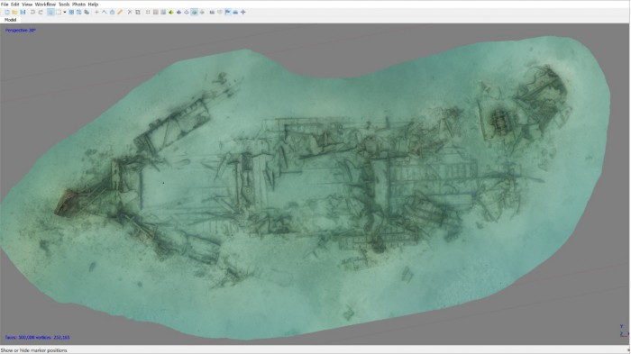
Rendered photomosaic of 50m long wreck recorded during the first week of diving

In the long term, areas of the sea bed will be surveyed to locate and identify more of Qatar’s underwater cultural heritage which includes submerged landscapes as well as shipwrecks. The Maritime Archaeology Trust (MAT) is working with the University of York, the Qatar Museums and Qatar University on the Qatar Maritime Archaeology Project (QatarMAP) to carry out these marine archaeological investigations. MAT divers visited Qatar in early May and diving from the dive boat Janan, with the help of divers from the Qatar University, carried out photographic survey over some shipwreck sites to produce 3D photomosaics which were calibrated with measuring scales positioned at different locations.

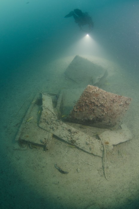
Diver from the Maritime Archaeology Trust conducting a 3D photomosaic survey on debris at the gravel pile

The MAT dive team are now back in Qatar to continue the work. Along with continued processing of data collected during the first week’s visit, testing and checking of geophysical equipment has been taking place until the bad weather abates which is likely to be this evening.

International Museum Day 2017: Shipwreck Centre and Maritime Museum, Isle of Wight

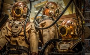
Antique diving helmets at the Shipwreck Centre

The Shipwreck Centre and Maritime Museum is a treasure hub of knowledge about the ocean’s sunken secrets, primarily around the Isle of Wight. Located at Arreton Barns Craft Village on the island, the museum attracts a visitor pool of all tastes and ages.

The collection held by the museum has almost solely been recovered and collected by Martin Woodward, a professional diver for 50 years. His passion for shipwrecks and maritime history has enthralled the public ever since he first opened his collection in 1978.

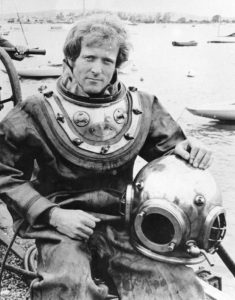
Martin Woodward testing the antique diving suit

The Shipwreck Centre holds an intriguing collection of curiosities. There is everything from antique diving equipment, ship’s navigational instruments, and artefacts recovered from famous Royal Navy vessels, to pieces of eight and even a real “mermaid”! Additionally there is also an exhibition dedicated the history and service of Lifeboats, with the focus on the Bembridge Lifeboat Station.

On the 11th April 2017, the Maritime Archaeology Trust took over the management of the Shipwreck Museum from Mr Woodward (blog post). Our plans for the future are to build on the amazing collection that already exists. We are looking to expand the museum for more displays, continuously research the artefacts and the stories that are connected with them, and also adding the latest high tech visualisation technology to display the collection in a modern light.

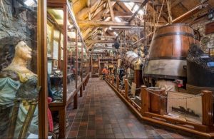
Inside the Shipwreck Centre

So in honour of the International Museum Day 2017 we would like to highlight this gem of a museum and hope that you will join us in making it even greater for the future.

For more information about the museum and to plan a visit, please see their website: http://shipwreckcentre.com/

Volunteering

If you be interested in volunteering and being part of shaping the museum for the future please contact: curator[at]maritimearchaeologytrust.org.

Supporting Us

To receive the latest news from the Trust, please sign up to our Newsletter: http://maritimearchaeologytrust.us3.list-manage.com/subscribe?u=90f4da1bc1dfe954c2280b284&id=3b0fd3fed4

Become a Friend of the Trust for only £1 per month and be involved in exclusive events and activities: http://www.maritimearchaeologytrust.org/friends

Lost beneath the waves: Ancient Landscapes and Wartime Wrecks

On Sunday 16th October, Garry Momber, Director of the Maritime Archaeology Trust, will be speaking at the Isle of Wight Literary Festival.

Garry’s talk will cover two archaeological projects of major interest and importance to the Island:

Bouldnor Cliff: A submerged pre-historic site eleven meters below the surface and approximately 250 metres offshore of Bouldnor, near Yarmouth. Excavations have been continuing at Bouldnor Cliff since the 8,000 year old Mesolithic settlement was first identified in 1999, when a lobster was seen throwing Stone Age worked flints from its burrow. Since then the site has yielded numerous secrets. The material so far recovered has already demonstrated that the technology of the era was 2,000 years ahead of what archaeologists previously believed.

HLF Forgotten Wrecks of the First World War: With over 1000 wartime wrecks along England’s south coast alone, the conflict of WW1 has left a rich legacy and many associated stories of bravery and sacrifice. These underwater memorials represent the vestiges of a vital, yet little known, struggle that took place on a daily basis, just off our shores.

Time: 10.30 – 11.30 am

Location: Northwood House, Isle of Wight

Cost: £8.50

Book your tickets here!

Menhir de la Tremblais

Near the village of Saint-Samson-sur-Rance, in Brittany, France, we find this interesting Neolithic piece of stone.

Pierre Longue menhir of Thiemblaye

The menhir stands alone at 6 meters in length, leaning at just over  45 degrees. It is a large block of granite and quartz, with a relatively polished, flat look.

Most of the time that is all it seems to be. However, when the sun hits it just right, beautiful markings and carvings appear. Carvings of crosses, leaves, axes, waves and various animals.


There are several legends surrounding this monument. One legend says it is one of three stones closing the entrance to hell. This belief gave it the name “Bonde de l’Enfer,” loosely meaning “Leap From Hell.”

Another legend says that a young girl who wants to get married should climb on top of the menhir and slide down in her “birth pants.” Subsequently, she will be wed within a year.

A final legend tells a story of Samson of Dol who faced the temptations of the Devil nearby, and when the Devil failed, it whipped the stone, creating some of the marks we can see today.


Find this interesting?
Follow us on Twitter
Like us on Facebook

Forgotten Wrecks of the Devon Coast: Geophysics and Diving

WholeAreaMap

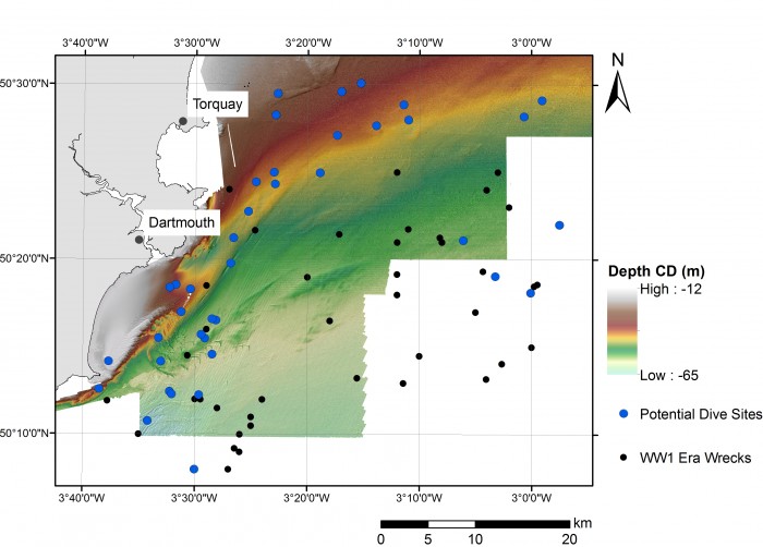
Distribution of First World War wrecks within the Devon study area (image credit: Contains public sector information, licensed under the Open Government Licence v2.0, from the Maritime and Coastguard Agency).

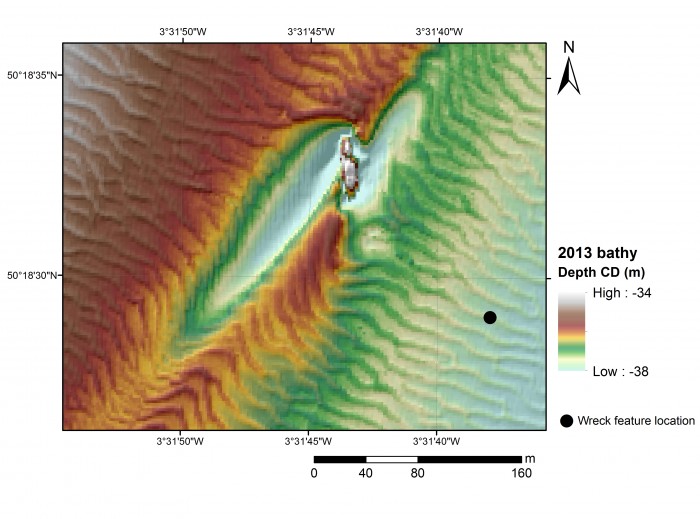
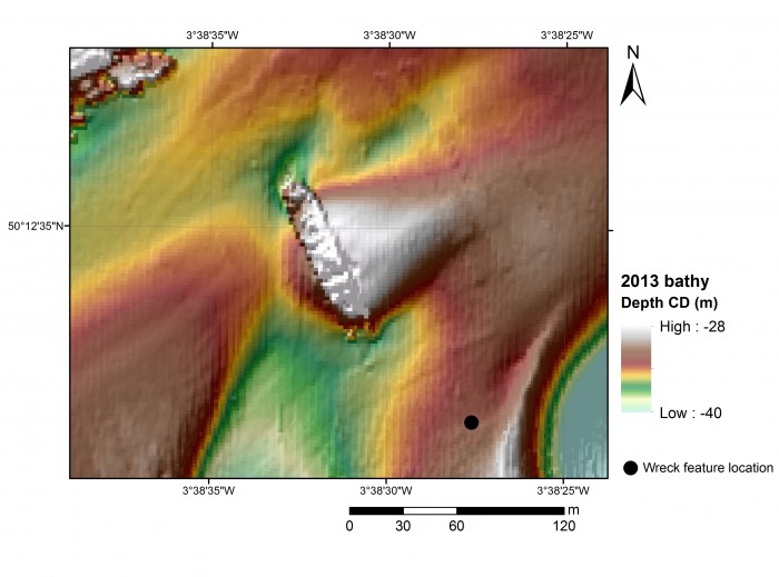
As part of the Forgotten Wrecks project this summer the Maritime Archaeology Trust sent out a team of divers to find and document a number of WW1 wrecks off the South Devon Coast. In order to assist the divers in finding these wrecks bathymetric maps were consulted. Much like navigational charts used by mariners these maps show the topographic features of the seafloor. However, modern techniques such as multibeam bathymetry, paint a far higher resolution image of the seafloor with measurements made every few metres.  As a result, even fine details such as the orientation of shipwrecks and the positions of larger objects such as boilers and anchors on these sites, can be seen.

Within the area surveyed by the Maritime Coastguard Agency between 2012 and 2015 (data freely available from aws2.caris.com) 31 of the 48 wrecks which had been identified as lying within the south Devon study area reviewed ahead of diving operations were visible.

Once identified a zoomed in map was created of each wreck. The examples shown here are of the British Navy trawler, the Benton Castle and cargo ship, the Newholm. Both of which sank after hitting mines, leading to the loss of 30 lives in total. These images and images of the other wrecks were used by the diving team to help select individual sites to dive and then plan their dives more effectively.

BentonCastle_geophysics

Geophysical survey image of the Benton Castle (image credit: Contains public sector information, licensed under the Open Government Licence v2.0, from the Maritime and Coastguard Agency).

Newholm_geophysics

Geophysical survey image of the Newholm (image credit: Contains public sector information, licensed under the Open Government Licence v2.0, from the Maritime and Coastguard Agency).

The dive team operated out of Dartmouth using Falcon Diving Charters (http://falcondivingcharters.com/) during the week of 27th June to the 1st July. Despite some challenging weather conditions the team managed to reach a number of the Forgotten Wrecks to undertake survey and photogrammetric recording.

Written by Amelia Astley

To find out more about the Forgotten Wrecks of the First World War project, click here.

Newholme_site_photo

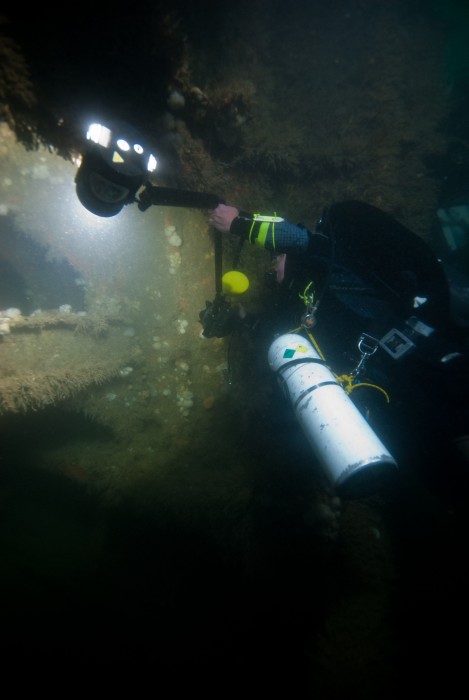
Diver photographs detail of the wreck structure of the Newholm.

Benton_Castle_site_photo

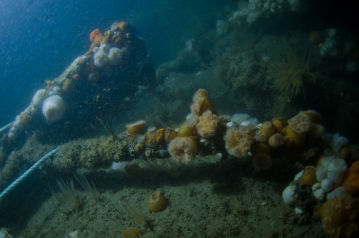
Marine life encrusts the remains of the wreck of the Benton Castle.


Across the Seas: ‘The Idol’, Peña Tú Asturias

Previously we have discussed some 3D-images of  French megaliths. The following 3D image is of a Neolithic stone shelter in Spain.

Located in the beautiful Sierra Plana de la Borbolla, at Llanes in Asturias, Northern Spain, ‘The Idol’ is a neolithic rock shelter which has preserved wonderful examples of prehistoric art.

The rock has been known by local inhabitants for a long time, but it was not until 1914 the first archaeological  investigations took place. ‘The Idol’ can be interpreted as a human form, featuring eyes, nose and feet wrapped in a cloth or robe. It might have represented a tribal elder or warrior, indicated by the adjacent dagger motif, thus making it likely that is was a funerary monument.

The images show crosses, demonstrating the site’s later Christianisation. In addition, we can find a faint animal motif and several red forms throughout.

It is likely that ‘The Idol’ is part of a series of sites dispersed across the region that are almost certainly connected with a wider common culture, stretching from Ireland to Scandinavia to Tunisia, in the Neolithic.

The site was surveyed by drone and Land Rover Defender.

Find this interesting?
Follow us on Twitter
Like us on Facebook

Bouldnor Cliff: A World Class Site

Mohamed Ziad

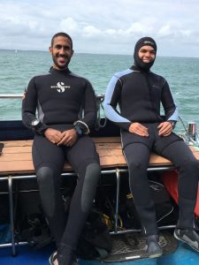
Mohamed and Ziad

Bouldnor Cliff isn’t just important from a British perspective: it is a unique site that interests people from all over the world! The diving team included archaeologists from the Maritime Archaeology Trust and even two divers who’d traveled all the way from Egypt to help with the work and see the remains of the Mesolithic settlement. Ziad and Mohamed flew to Britain when volunteers were needed to join the Bouldnor Cliff survey, and came to help with the photogrammetry work around the site. They’ve done work all around the world, including in Montenegro, Lebanon, Egypt and Italy, but this was their first time diving in the U.K.

Ready for that renowned British summer, Ziad and Mohamed joined the team on the boat, keen to explore the famous site. Undeterred by the wind and rain of the first day (it is summer, after all), they were ready to get stuck in and brave the chilly Solent. Layered up and as prepared as can be for the colder climate they jumped in to get to work. The cold was no match for their enthusiasm and they worked hard, familiarising themselves with the site and the new conditions.

And what did they have to say after their first dive? Ziad had only one word: ‘challenge’!

Now used to the cold and the weather, they carried on diving on the site, contributing hundreds of photos to the photogrammetric survey, and taking footage on a GoPro. Their dedication is such that the skipper even poured warm water into their wetsuits before a dive! Inspired by Ziad’s one-word summary, Mohamed described the site as an ‘adventure’.

Ziad and Mohamed aren’t the only members of the #SaveBouldnor team from abroad – Sarah is from the United States, and Miguel is a PhD student from Lisbon, Portugal. Sarah works at the Maritime Archaeology Trust, and considers the site to be ‘groundbreaking’!

Miguel came to Bouldnor Cliff to gain experience in a new environment, and to improve his skills in 3D reconstruction and recording. Miguel described the site as ‘exciting’ and has contributed a lot of work to the photographic record.

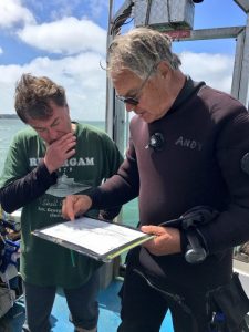
It’s not just maritime archaeologists who find Bouldnor Cliff fascinating – Andy has worked closely with the Trust for fifteen years. He finds the site ‘remarkable’, and, as a long-time diving enthusiast, is helping out on-site.

Bouldnor Cliff is a special site that is always turning up new information and fascinating artefacts. It has something of interest for people from all over the world, from different backgrounds, and this multi-national team has come together to work to save Bouldnor, and learn its secrets. Work like this is invaluable, and will contribute to the continuing record of Bouldnor Cliff, as the MAT monitor the site’s condition and explore new features.

Bouldnor Cliff Day Two: 15/06/2016

Photo 15-06-2016, 15 03 58  Another day on Bouldnor Cliff reveals another exciting discovery. Garry Momber took part in the day’s first dive, and began to clear away some of the layer of mud covering the site. Underneath this mud he found a series of planks lying parallel to each other. Further dives will include more work on this potential platform, so the archaeologists can try to interpret the feature and its purpose. Yesterday, a diver found and recovered a small piece of flat, pointed timber that may turn out to be the end of a plank. Garry also recovered a small piece of wood, demonstrating the excellent preservation on this site. It is still possible to find organic material that is over 8,000 years old!
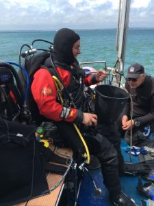
Photo 15-06-2016, 15 20 56Miguel, Ziad, and Mohamed are still hard at work on the photogrammetric work. Miguel has been acting as underwater photographer, taking pictures of Garry at work and using a 6m x 2m grid to take photos to create a photogrammetric model of the site and some of the exposed timbers. Ziad and Mohamed are doing similar work, both with and without photogrammetric targets. The divers are working hard to ensure they don’t damage any of the exposed timbers as they do their work, and are being careful where they use targets. In places where the timber is fragile, it may be better to work without them. Eventually, the hundreds of photos taken will be combined together. They will be used to create a 3D model of the Mesolithic site, which can be manipulated and interpreted, and used for further study.

To everyone’s delight, the weather is much improved from yesterday, and conditions are much calmer. This is Ziad and Mohamed’s first time diving in the UK, but they are coping with the temperatures very well! On the third dive, the divers brought up some more timber which will be cleaned, and then studied for interpretation.

Every dive is revealing something new about the site. The researchers are keen to see what else can be learnt from this ancient settlement. Bouldnor Cliff is a unique site, and it has plenty more secrets to discover!


Older posts Newer posts